I have recently encountered mapping in my English 256B class. It was something completely new to me that I never knew about before. I have always associated maps with places and countries only. But I never thought of a map that could show me the most genre of the books that have been read by university students, for example. However using the mapping tools in my English class taught me a lot of things about mapping. I learn to map different things and was able to analyze the results without having to read closely or even do a long research.
Google My Maps will be the first tool I will be talking about. The interesting thing about Google My Maps was the idea that it was launched by Google, and I have never used it before. It was launched in 2007 and it is a tool that enables its users to create maps for their own personal use. In this tool you can add lines, point, and shapes to your map. You can choose any destination or anything you want to map. A map can have up to 10,000 lines, shapes, or places. You can also add a layer in your map to increase thickness. A layer can also have 2000 lines, shapes, or places. Not only you can create a map for a city or a country, but also you can also search for places in that map. These could be restaurants, hotels, museums, and many other places in your map.

Another digital mapping tool development is Topo Text. Topo text combines different open access tools. It automatically identifies all the place names that are mentioned in the text and put it in a map. So literally, if you put a text, no matter how big the text was. Topo text will be able to take all the places in the text. You can even specify that, for example, you want all the places mentioned in a specific country (Germany, America, London, etc.) in the text. It also calculates the most frequent words mentioned within a specific proximity of a place name. So you can say “what are all the words mention in Italy” and it will show you. Or for example you are interested in Charles dickens said about London, it will give you the most frequent words around that specific place. Which eventually allows you to create a word map, which is the most interesting part about Topo Text. This is my favorite tool of mapping.

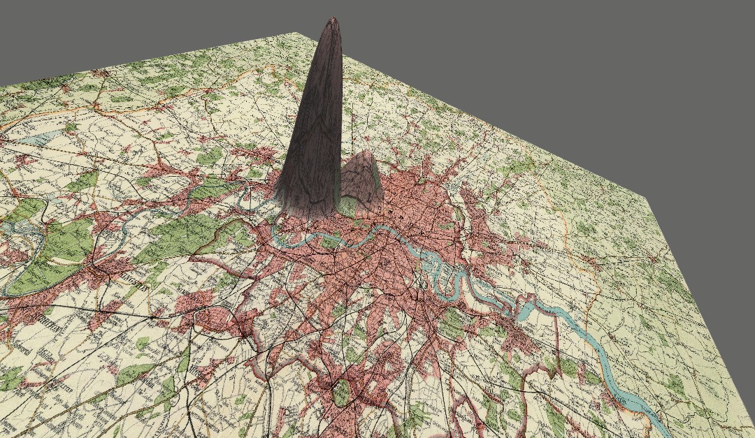
The third and final tool used was the Z axis tool. It is a very simple tool. All you have to do is just upload a text or just copy and paste a text of a novel from Gutenberg.net. After that, you can edit the list of place names. You can reassign them to categories such as “people” or “University” or anything else. The Z-axis on the map will correspond to the frequency of certain place names mentioned. It is a tool that is accessible for everyone and would be very helpful, especially when doing projects about certain novels and trying to understand authors.
I think that was is good about mapping Is that it is similar to distant reading and allows you to analyze and take results from a bigger picture. However, I believe that what is bad about maps is that they are never fully perfect. Although they may not include any errors, but details from the real world seem to be missing. Also, when talking about maps that are not for places, but ideas, they could lack information and will only give you a brief overview.
